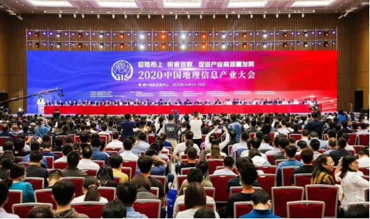
On October 23, the 2020 China Geographic Information Industry Conference was held in Nanning, Guangxi. The "China Geographic Information Industry Development Report 2020" was released at the conference. The report shows that in 2019, the total output value of my country's geographic information industry reached 647.6 billion yuan, a year-on-year increase of 8.7%. As a strategic emerging industry, the geographic information industry has become a new growth point and new development momentum for my country's digital economy.

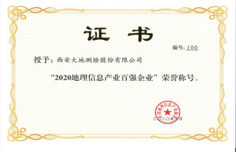
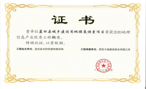
The 2020 China Geographic Information Industry Conference has the theme of "Rising up to difficulties, forging ahead and promoting the high-quality development of the industry". The conference released the 2020 top 100 companies in the geographic information industry, the most dynamic small and medium-sized enterprises, and the top 50 high-growth companies, commending the 2020 Geographic Information Technology Progress Award and the 2020 Geographic Information Industry Excellent Project. Xi’an Geodetic Surveying and Mapping won the honorary title of “2020 Top 100 Enterprises in Geographic Information Industry”; the “Lantian County Urban and Rural Construction Land Survey Project” undertook won the Bronze Award of 2020 Geographic Information Industry Excellent Project.


The conference also held high-end forums, innovation shows, and 14 sub-forums on different topics, including a new generation of 3D GIS, natural resource spatial informatization, intelligent geographic backplane, digital economy, satellite remote sensing, and drone aerial surveys. Experts and entrepreneurs in geographic information and related fields gave more than 130 reports on different topics. At the same time, the Geographic Information Industry Achievement Exhibition was held to showcase new technologies, new products and new equipment in the geographic information field.
The meeting emphasized that geographic information is an important support for natural resource management and an important foundation for economic and social development. Surveying and mapping geographic information plays an increasingly important role in supporting the "two unification" management of natural resources, the construction of real three-dimensional China, and twin cities. In the future, surveying and mapping geographic information will also usher in greater development opportunities and challenges. As one of the top 100 geographic information companies and a listed company on the New Third Board, Geodetic Surveying and Mapping is bound to lead by example, "face up to difficulties, forge ahead" and make due contributions to high-quality development.