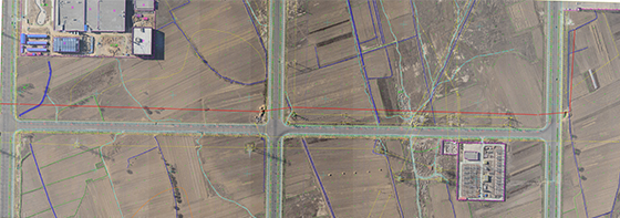
Project Overview:
The starting point of the Hohhot-Baotou-Ordos oil product pipeline project is at the Hohhot branch of PetroChina in Hohhot, passing through Hohhot, Baotou, and Ordos. The line is about 316km long. Large-scale river crossings are mainly the Yellow River; highway crossings mainly include G0601, S31, G65, G210, G109, and G18; railway crossings include Baoxi Railway and Hubao Railway. The whole line is low in the east and high in the west, with a height difference of about 500 meters. The eastern part is about 200km flat, with vertical and horizontal roads, and convenient transportation; the western part is mostly mountainous and hilly, with sparsely populated areas, less vegetation on the ground, and relatively inconvenient transportation.
Project highlights:
This project is based on the latest existing national surveying and mapping specifications, and the project design adheres to: Based on the accuracy indicators proposed in the "Specifications", boldly adopt new technologies and new processes to improve work efficiency, reduce engineering costs, and increase efficiency through scientific management Yes, strictly implement the ISO9000 standard, strengthen process tracking and inspection to ensure product quality. In the implementation of the project, security and confidentiality are combined, and the accuracy of the results is better than the specification requirements.
Through the advanced control network layout, the original national control points of the whole line are scarce, the traffic difficulties are overcome, and the cold winter (February 2012, Hohhot -7°~-20°) and other unfavorable factors are effectively controlled. , Which created conditions for the comprehensive staged work and accelerated the progress of the project played a decisive role.
Taking into account the area of the shooting area, the height difference, the maximum ceiling of the drone, the resistance to wind, and the safe operating height, the drone aerial photography is used to quickly obtain the image data of the survey area, and the “intelligent surveying and mapping drone low-altitude remote sensing system "With its own program for automatic route design, improve work efficiency. Use GPS-RTK technology for route design breakout stakeout, use advanced 3D product production process for data collection and mapping, use DEM data to extract line centerline longitudinal section data and other technological methods to improve product quality and production efficiency.
